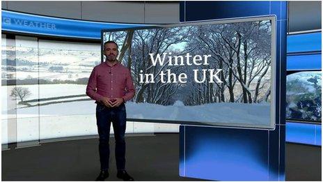
UK weather: How long will the cold snap last?
- Published
The UK is in the grip of a spell of severe cold weather, with snow, ice and fog warnings in place across the UK.
Forecasters think we're likely to be experiencing icy temperatures until the weekend, but what's causing the cold snap and should we be surprised?
Isn't December always chilly?
Temperatures in the UK were about average for December at the start of the month - with daytime highs between 8C (46F) in southern England and 5C (41F) in Scotland - but they have now dropped substantially with minus temperatures recorded across the country.


Monday was the coldest day in the UK since December 2010, according to provisional data from the Met Office, with a highest recorded temperature in Braemar, Aberdeenshire, of -9.3C (15.2F) - the lowest recorded maximum temperature for 12 years.
Braemar had already experienced the coldest night since February 2021 on Sunday with a lowest recorded temperature of -15.6C (3.9F) and overnight temperatures fell even further to -17.3C (0.8F) on Monday night.
England recorded its coldest temperature yet this year on Monday night, plummeting to lows of -11.8C (10.7F) at Redesdale in Northumberland.
Katesbridge, in County Down, fell to -9C (15.8F) through the early hours of Monday morning making it the coldest night recorded in Northern Ireland since January 2021. Wales recorded its coldest night since January 2021 on Sunday, with -8.8C (16.2F) at Sennybridge, although Monday night was slightly warmer.
Snow and ice across the UK forced some schools to close and caused widespread travel disruption on Monday. Further snow is likely in the next few days but not as widespread, with the majority falling across northern Scotland.
Data from the European Centre for Medium-Range Weather Forecasts shows how northern Europe - including the UK - is expected to be colder than usual across the course of the week, while southern Europe is expected to be warmer than usual.

What is causing the cold snap?
There has been a large area of high pressure over Russia for some time and a second high pressure system has built up across Greenland and Iceland.

The second is moving slightly further west, forcing cold Arctic air to flow south between the high and low pressure systems and over the UK - a so-called Arctic blast.

That flow of cold air is then reinforcing the highs, resulting in what is known as a "blocked pattern" with the high pressure areas remaining in place for several days.
BBC Weather presenter Matt Taylor says there are some low pressure systems in the Atlantic that will probably push into western Europe and could eventually break down the blocked cold weather pattern.
This change is expected to come about through the weekend, with the chance of more snow as the less cold air pushes in, before milder air turns any snow to rain.
Why does it feel even colder?
The cold weather comes as a particular shock because we've had a very warm autumn - the third warmest on record for the UK.
Met Office data shows just how much warmer than usual September, October and November have been, with mean highest daily temperatures in some places 2.5C above the average between 1990 and 2020.

It's also been a while since we've had a really cold December in the UK.
December 2010 was the coldest on record for the UK based on mean temperatures - and also very snowy. The first half of December 2012 was also well below average but much milder weather in the second half of the month meant it ended up about average overall.
Since then, December cold spells have been short and infrequent.
How low will temperatures fall?
Weather for the Week Ahead
Temperatures are expected to remain low for several days, with overnight lows below freezing in many towns and city centres.
And although temperatures for many will be back above freezing during the day, forecasters warn the northerly wind means it could feel much colder.
Find out the weather where you are.
Does it mean there will be snow at Christmas?
There are not many indications that this cold spell will remain in place until Christmas and temperatures are expected to return to average in the week leading up to Christmas Day, BBC Weather's Nikki Berry says.
Traditionally the Met Office defined a white Christmas as one snowflake being observed falling in the 24 hours of 25 December at the Met Office building in London.
However, with the rise in betting on where there could be a white Christmas it increased the number of locations observed and they now include sites such as Buckingham Palace, Edinburgh Castle, Coronation Street in Manchester and the Millennium Stadium in Cardiff.
For Oddschecker, the odds on a white Christmas is determined by whether there is snowfall recorded in each city's respective airport.


The BBC Weather app is only available to download in the UK.


Have you been affected by the cold snap? If it's safe to do so, please email: haveyoursay@bbc.co.uk.
Please include a contact number if you are willing to speak to a BBC journalist. You can also get in touch in the following ways:
- WhatsApp: +44 7756 165803
- Tweet: @BBC_HaveYourSay
- Upload your pictures/video here
- Or fill out the form below
- Please read our terms & conditions and privacy policy
If you are reading this page and can't see the form you will need to visit the mobile version of the BBC website to submit your question or comment or you can email us at HaveYourSay@bbc.co.uk. Please include your name, age and location with any submission.

Related Topics
- Published10 December 2022
- Published3 April

- Published23 November 2023